If you want Scripture to feel more geographically clear, a good atlas can make a major difference. The best Bible atlases help you follow journeys, understand kingdoms, and place biblical events in their historical settings.
Below, we’ve rounded up 10 strong options for study, teaching, and personal reading, with choices that range from beginner-friendly visuals to more in-depth academic references.
Best 10 Bible Atlases Picks for 2026
Gold Standard Reference

- 132 full-color maps and 100+ photos
- Aligned with specific biblical texts
- Strong coverage of geography, history, and culture
Best For: Pastors, teachers, and students needing a deep study atlas
Visual Classroom Pick
Deluxe Then and Now Bible Maps

- 8 clear overlays compare Bible places to modern locations
- Spiral binding and larger type aid group use
- Includes maps, charts, timelines, and story sections
Best For: Sunday School, homeschool, and visual Bible study
Compact Photo-Driven Pick
National Geographic Atlas of the Bible

- Compact 112-page atlas of the Holy Lands
- Lightweight and easy to handle
- Good entry-level option for Bible geography
Best For: Readers wanting a compact atlas from a familiar brand
Most Comprehensive Revision

- Full-color maps, photos, graphics, and charts
- Covers biblical history from Eden onward
- Includes dictionary and index for study
Best For: Readers wanting a visually rich, in-depth Bible geography atlas
Most Context-Rich Pick
Bible geography with modern context

- Over 120 detailed Bible maps
- Modern city and country overlays
- Background on 30 Bible characters
Best For: Readers who want a people-focused atlas with added historical and cultural context
Best Deep-Dive Study Tool
Comprehensive study atlas for ESV readers

- More than 175 full-color maps
- 70 photos plus 3-D recreations
- 65,000 words of narrative description
Best For: ESV readers and serious students who want a detailed modern reference atlas
Best Scholarly Update
Updated atlas with archaeological detail
- 27 full-color maps
- 81 color illustrations
- Revised for recent scholarship and archaeology
Best For: Readers who want a concise, academically updated atlas with accurate maps
Scholar's Choice

- 119 full-color maps with historical context
- Over 100 new color photos
- Strong indexes and endnotes for study
Best For: Pastors, teachers, and serious Bible study
Budget-Friendly Study Aid

- Clear, colorful, and easy to use
- Thirty maps across Old and New Testaments
- Handy place-name index and archaeology guide
Best For: Students, families, and budget-conscious buyers
Kid-Friendly Visual Guide
The Bible Atlas: Pictorial Guide

- Illustrated maps for ages 9-12
- Covers major Old and New Testament events
- Accessible visual layout with modern fonts
Best For: Children who learn best from pictures and maps
Gold Standard Reference – Holman Bible Atlas
Holman Bible Atlas: A Complete Guide to the Expansive Geography of Biblical History
Check Price On AmazonIf you want one of the most comprehensive bible atlases available, the Holman Bible Atlas is built for serious study. With 132 full-color maps, photos, timelines, chart summaries, and sidebars, it organizes biblical geography alongside historical periods so readers can connect places, people, and events with ease.
Best For: Pastors, teachers, and students who want a detailed, text-aligned study atlas for biblical history.
Pros:
- 132 full-color maps plus more than 100 color photographs
- Covers geography, history, culture, empires, people groups, and ancient road systems
- Arranged in line with specific biblical texts for clear study use
- Includes timelines, charts, and helpful sidebars
Cons:
- At 256 pages and 3.25 pounds, it is less portable than smaller atlases
- Its depth may be more than casual readers need
The Holman Bible Atlas stands out as a broad, well-organized reference for readers who want both visual context and historical detail. If your priority is an in-depth atlas that supports teaching and study, this is a strong pick.
Visual Classroom Pick – Deluxe Then and Now Bible Maps
Deluxe Then and Now Bible Maps is a practical choice if you want bible atlases that make geography easy to visualize. Its clear plastic overlays show modern cities and countries on top of Bible maps, and the updated edition adds new pages, relief maps, illustrations, diagrams, and larger type for easier reading.
Best For: Sunday School, homeschool, and Bible study groups that benefit from overlays and simple map comparison.
Pros:
- 8 clear plastic overlays show modern places on top of Bible maps
- Spiral binding helps the book lie flat during use
- Larger, easier-to-read type than most Bible atlases
- Includes maps, charts, timelines, and story-specific map sections
Cons:
- Only 66 pages, so it is lighter on depth than larger atlases
- Designed more for clarity and teaching than for exhaustive reference
This edition is especially useful when the goal is quick understanding rather than extensive historical coverage. The overlays and updated geography make it easy to show where Bible places are today.
Compact Photo-Driven Pick – National Geographic Atlas of the Bible
The National Geographic Atlas of the Bible is a concise option among bible atlases, especially if you prefer a lighter, easier-to-handle format. At 112 pages, it offers an accessible way to explore the Holy Lands without the bulk of a larger reference book.
Best For: Readers who want a compact Bible atlas from a trusted travel and geography brand.
Pros:
- Compact 112-page format is easy to manage
- Focused on exploring the Holy Lands
- Lightweight compared with many full-size atlases
Cons:
- Supplied details do not list extras like maps, photos, or charts
- Likely less comprehensive than larger, more detailed atlases
If you want a straightforward atlas that is easy to store and carry, this one fits the bill. It is a good entry point for readers who want a compact overview rather than an all-in-one study resource.
Most Comprehensive Revision – Zondervan Atlas of the Bible
Zondervan Atlas of the Bible: Revised Edition, Full-Color Maps, Photos, Graphics, and More
Check Price On AmazonThe Zondervan Atlas of the Bible is a strong choice if you want bible atlases with a wide scope and a polished visual presentation. This revised edition combines full-color maps, photos, graphics, and chronological charts to trace biblical history from Eden through the New Testament, while also adding a geographical dictionary and detailed place-name coverage.
Best For: Readers who want a visually rich, historically organized atlas for deeper Bible geography study.
Pros:
- Stunning multidimensional and three-dimensional maps
- Over 100 new images plus revised text and graphics
- Historical flow from Eden through the Old and New Testaments
- Includes a geographical dictionary and index for deeper study
Cons:
- At 304 pages and 2.6 pounds, it is not the most compact option
- Its level of detail may be more than casual readers require
This atlas is ideal when you want strong visual support and a more complete historical framework. It is especially appealing for readers who like to move from overview to detailed reference in one book.
Most Context-Rich Pick – Bible geography with modern context
If you want Bible atlases that do more than show locations, this edition adds context that helps explain why places and journeys mattered. With over 120 maps, modern overlays, travel-direction lines, and notes on key Bible people and events, it is built for readers who want to connect geography with interpretation.
Best For: Readers who want a people-focused Bible atlas with detailed background and modern location overlays.
Pros:
- Includes over 120 detailed Bible maps.
- Clear plastic overlays show where Bible places are today.
- Provides background on 30 important Bible characters.
- Maps include travel directions and helpful notes.
Cons:
- Heavier, reference-style format may be less convenient for casual use.
- Focuses more on background and people than on quick map lookup alone.
This is a strong pick if you want an atlas that connects biblical stories to land, culture, and movement rather than offering maps by themselves. The added explanatory text makes it especially useful for study time.
Best Deep-Dive Study Tool – Comprehensive study atlas for ESV readers
Among Bible atlases, this one stands out for its blend of technical detail and readability. It offers a large set of full-color maps, photos, 3-D recreations, timelines, indexes, and narrative explanation, making it a strong reference for readers who want an up-to-date study tool.
Best For: ESV readers and serious students who want a highly detailed, modern Bible atlas.
Pros:
- More than 175 full-color maps.
- Includes 70 photographs and 3-D recreations of biblical objects and sites.
- Provides indexes, timelines, and 65,000 words of narrative description.
- Features regional maps for areas like Egypt, Mesopotamia, Italy, and Greece.
Cons:
- Large, reference-heavy format may be more than casual readers need.
- Designed specifically with ESV readers in mind.
If you want a comprehensive atlas with substantial explanatory material, this is one of the strongest options. The mix of maps, images, and narrative makes it well suited to deeper Bible study.
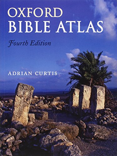
Best Scholarly Update – Updated atlas with archaeological detail
If you are comparing Bible atlases for accuracy and scholarship, this revised edition is a practical choice. It combines full-color maps and illustrations with updates drawn from recent biblical scholarship, archaeology, and topography, giving readers a clear view of the biblical world.
Best For: Readers who want a concise, academically updated Bible atlas with accurate maps.
Pros:
- Thoroughly revised fourth edition.
- Includes 27 full-color maps.
- Features 81 color illustrations.
- Updated with recent biblical scholarship and archaeological discoveries.
Cons:
- Has fewer maps than some larger Bible atlases.
- More compact than highly detailed reference-heavy alternatives.
This atlas is a good fit if you value accuracy, visual clarity, and scholarly revision in a smaller package. It balances maps and illustrations well without becoming overwhelming.
Scholar's Choice – The Moody Bible Atlas
If you’re comparing bible atlases for serious study, The Moody Bible Atlas stands out as a full-featured reference built around geography, history, and biblical context. This updated third edition adds new research, refreshed maps, and more photos, making it useful for sermon prep, lessons, and personal Bible study.
Best For: Pastors, teachers, and Bible readers who want a detailed, scholarship-driven atlas with strong historical and geographic context.
Pros:
- 119 full-color maps covering Canaan, the Mediterranean, the Near East, Sinai, Turkey, and more
- Over 100 new color photos of locations and artifacts
- Comprehensive coverage from Eden to Jerusalem to Rome
- Includes endnotes plus map, general, and Scripture citation indexes
Cons:
- At 352 pages and over 3 pounds, it is less portable than simpler atlases
- Its academic depth may be more than casual readers need
This is the kind of Bible atlas that rewards close study, especially if you want maps tied closely to historical and theological discussion. It is a strong pick when accuracy, context, and depth matter most.
Budget-Friendly Study Aid – The Student Bible Atlas
The Student Bible Atlas is a practical choice if you want bible atlases that are clear, colorful, and easy to use without a big price tag. This revised edition keeps the trusted content and adds a cleaner layout with new maps that present essential information in a crisp, up-to-date way.
Best For: Students, families, and budget-minded buyers looking for an accessible atlas with simple maps and broad Bible coverage.
Pros:
- Clear, colorful design that is easy to follow
- Thirty maps covering both Old and New Testaments
- Helpful index of place names
- Includes a guide to major archaeology sites in the Middle East
Cons:
- Only 32 pages, so it is less comprehensive than larger atlases
- Best suited to general orientation rather than deep research
This atlas works well as a straightforward companion for Bible reading and basic location study. If you want a readable overview rather than an in-depth reference work, it is an easy recommendation.
Kid-Friendly Visual Guide – The Bible Atlas: Pictorial Guide
If you’re shopping for bible atlases for younger readers, this DK pictorial atlas is designed to make biblical geography easy to understand. It uses illustrated maps, modern fonts, and a visual format to help children follow the stories, places, and people of the Old and New Testaments.
Best For: Children ages 9-12 who learn best from illustrations, maps, and simple explanations of Bible events and locations.
Pros:
- Beautifully drawn maps that show where Bible events took place
- Illustrated, accessible format for ages 9-12
- Covers key events, journeys, and landmarks from both Testaments
- Includes details on how people lived and what locations look like today
Cons:
- Short 64-page format limits depth
- Designed for children, so it is not a serious study atlas for adults
This is a strong visual introduction to the Holy Lands for young readers who need maps to bring Bible stories to life. It favors clarity and engagement over detail, which makes it ideal as a first atlas.
How We Picked These Bible Atlases
We focused on Bible Atlases that offer accurate mapping, clear timelines or historical notes, and useful visual context for readers at different levels. We also looked for editions that are well organized, easy to navigate, and practical for study, whether you’re reading at home, preparing a lesson, or leading a small group.
Because buyers use atlases differently, this list includes options with strong photography and illustrations, as well as more research-oriented volumes with deeper historical detail.
Quick Comparison
If you want a fast visual companion, choose an atlas with color maps and strong illustrations. If you want deeper study support, look for more extensive background notes, historical coverage, and clearer indexing. Students and casual readers usually benefit most from simpler layouts, while teachers and serious study users may prefer denser reference material.
Key Buying Factors for Bible Atlases
Map Clarity and Readability
Maps should be easy to read at a glance, with labels that are large enough to follow without strain. Good color contrast, clean legends, and consistent place-name formatting make a big difference.
Historical and Biblical Context
The best Bible Atlases do more than show locations. They explain movements, empires, trade routes, and the setting of major events so the geography supports interpretation rather than distracting from it.
Depth Vs. Simplicity
Some atlases are built for overview use, while others are designed for more serious study. If you want a visual companion for devotional reading, a simpler atlas may be ideal. If you need something for teaching or detailed research, choose a more comprehensive one.
Format and Durability
Consider binding, page size, and whether the book is easy to keep open on a desk. Larger layouts often improve map visibility, but they can be less portable.
Who Should Buy Which Bible Atlases?
New readers and students: Choose a clear, visually guided atlas with straightforward maps and basic explanations.
Teachers and ministry leaders: Look for fuller background notes, timeline support, and strong visual aids that work well for lesson prep.
Serious Bible study users: Pick a more detailed reference-style atlas with richer historical analysis and broader coverage of biblical lands.
Gift buyers: A visually appealing atlas with accessible language is usually the safest choice.
In short, the right atlas depends on how deeply you want to study. The best Bible Atlases make Scripture easier to place in time and space, helping the text come alive without overwhelming the reader.